
In a canyon in Hocking Hills, Ohio, a group of men wearing 18th century-style clothing used surveying instruments to map the wilderness around them. The methods of the re-enacting surveyors were captured on camera in the heat of summer in 2019, but the scenes would have looked much the same more than 200 years ago.
Re-enacted photography by Dan Patterson and a narrative by Mercer University professor Dr. Clinton Terry combine to bring history to life in Surveying in Early America: The Point of Beginning, An Illustrated History.
The award-winning book, published by the University of Cincinnati Press in February 2021, details the techniques that professional surveyors used to map and divide the land of early America in the late 1700s. While other books have focused on specific surveying projects, this one is dedicated to the art and science of surveying itself, said Dr. Terry, associate professor of history and liberal studies in Mercer’s College of Professional Advancement.
Dr. Terry has always been interested in and taught about technologies, including a course he developed called “Technology and Culture in American History.” Surveying is something people take for granted, but every piece of property they visit has been surveyed and documented, he said.
The history behind that is interesting and important. Starting in the 1720s, the profession of surveying advanced rapidly and was fully developed by the early 1800s. However, there was little change in surveying technologies until the 1970s, when laser, radio and GPS were introduced.
“I found out that there was relatively little recent scholarship on the topic (of the development of surveying),” Dr. Terry said. “As Dan and I started looking at it, we started asking the question, ‘Can we use present-day photography with historical subjects, as a primary source, as evidence for scholarship?’ We decided that we absolutely could. The photography is absolutely first-rate. The text is what would be an academic history of the profession in the colonies in the United States.”
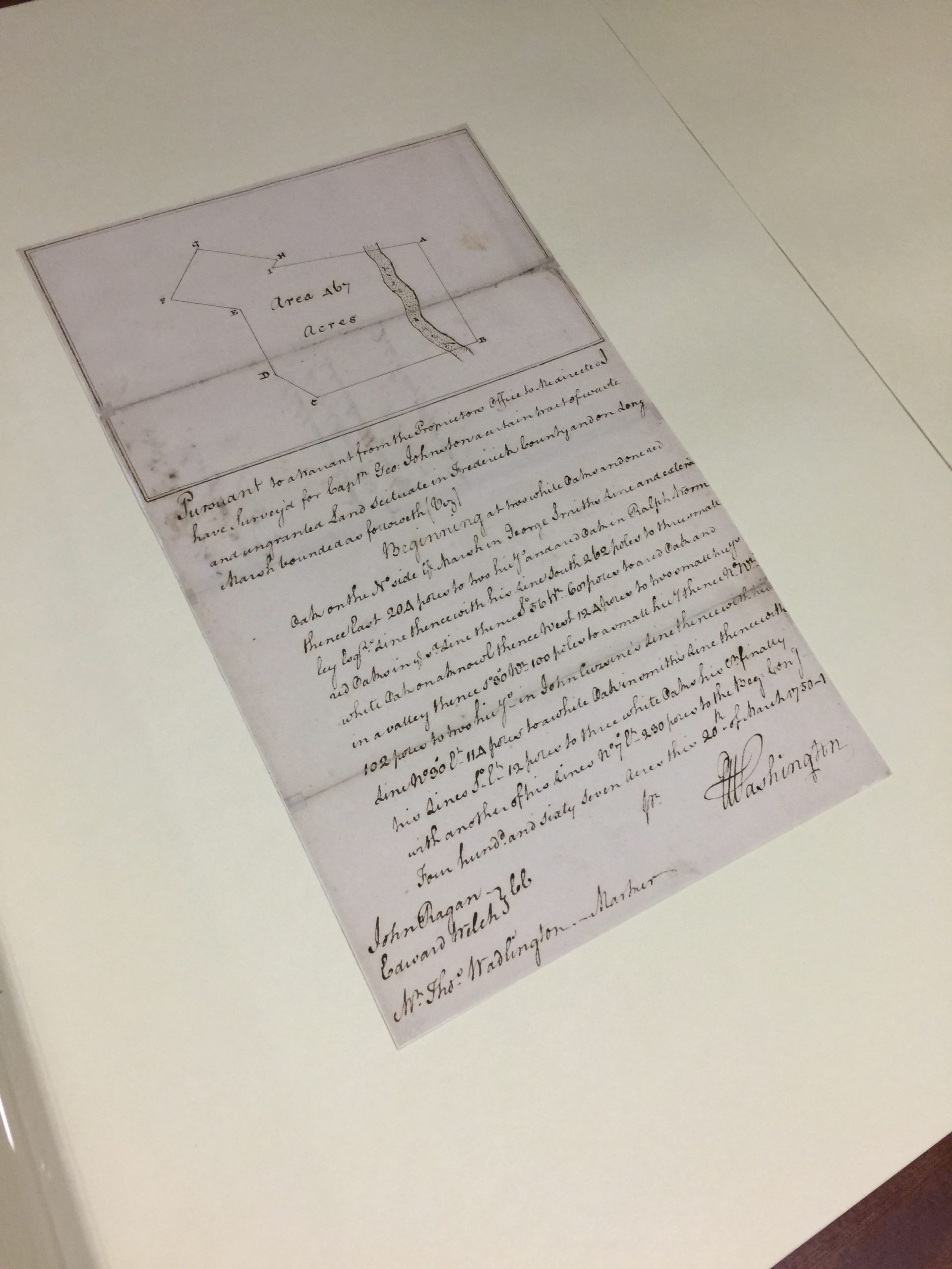
Dr. Terry used 18th century source materials as much as possible in his research, including surveying instruction manuals and the papers of George Washington. While America’s first president didn’t develop the surveying profession, he used the techniques often and documented his efforts. Therefore, the book prominently features Washington, from his teenage years as a professional surveyor to his military career where he was always in need of better maps to his 1777 request for Congress to establish the Department of the Geographer, a formal mapping unit for the Continental Army.
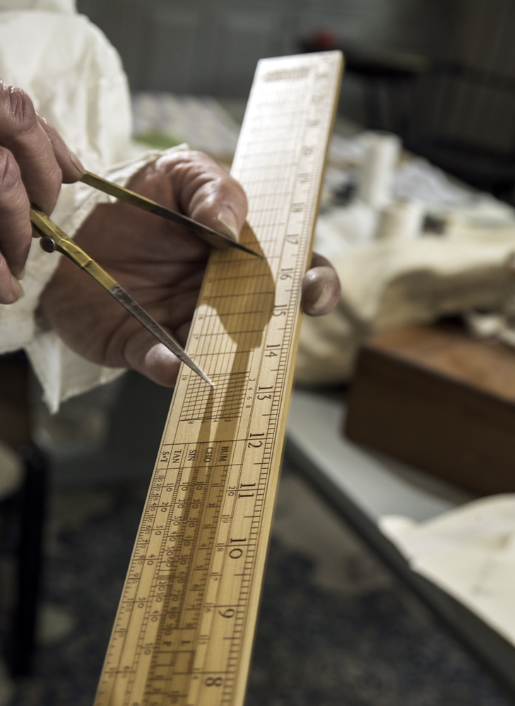
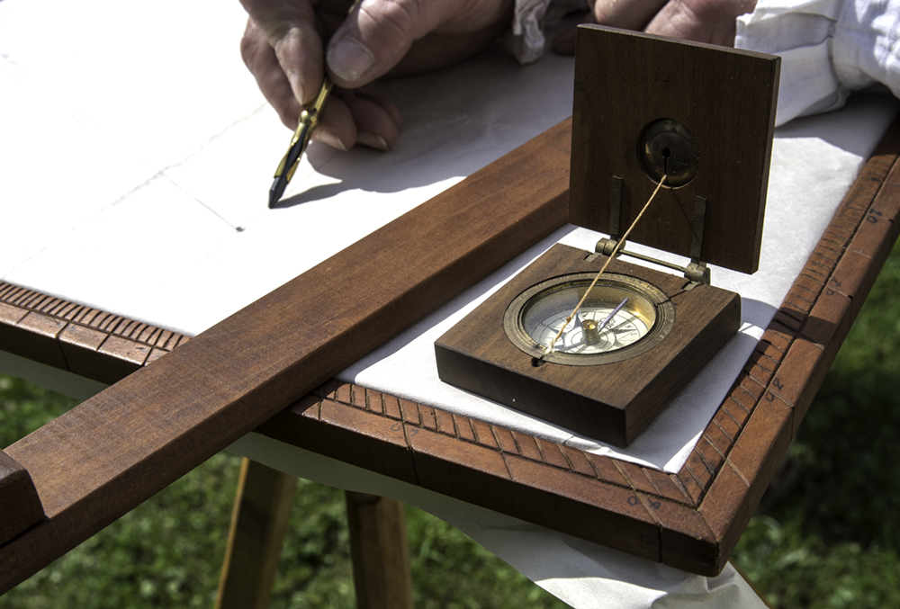
Today, the Department of the Geographer exists as a re-enactment group, where members follow the 18th century manual as they survey land. They use period-correct methods and equipment, dress in historically accurate clothing and uniforms, and survey in period-correct settings.
This re-enactment group actually sparked the initial idea for the book. Patterson and Dr. Terry have been friends since the 1980s, and they always talked about doing a historical project together. Around 2000, Patterson made contact with the Department of the Geographer, which sparked a project of mutual interest for the pair.
The re-enactors later agreed to be featured in the book, and Patterson photographed them surveying in both civilian clothing and military uniform in two forest locations in what’s known as the Seven Ranges of Townships in Ohio. One of the areas is in the process of being allowed to return to “old growth forest” and has not been touched for more than 50 years.
“They are very serious about getting this right. This is more than a hobby to them. When they are out in the field, they are following the unit manual to the letter,” Dr. Terry said. “Each of the photographs was a snapshot of them doing exactly what they would do if they were surveying a map. None of this is staged.”
Academic histories have largely consisted of words on paper in the past, but public history efforts in more recent decades have embraced other source materials. The re-enacted photography in Surveying in Early America provides new visuals to better contextualize this chapter of history.
“There are all kinds of new and exciting ways of approaching our study and recollection of the past and its meaning to ourselves in the present and future,” Dr. Terry said. “There are a tremendous amount of possibilities here if photography can be used as a primary source. If re-enacting and recreation with attention to historical detail is valid, this was our attempt to do a project with regard to that.”
Surveying in Early America has been well-received since its publication. The book won gold in the general history nonfiction category at the 2022 Midwest Book Awards this summer.
The authors have done a number of presentations on their research, including for a Smithsonian Associates online program in July 2021; the George Washington Symposium at Mount Vernon in November 2021; the Filson Club Historical Society in Louisville, Kentucky, in June; and the Nebenzahl Lectures on Surveying Performance at the Newbury Library in Chicago last month.